Things to Do Near Mt. Baker: The Year-Round Guide
What's actually open near Mt. Baker changes by season. Here's what to do year-round, from the December lift lines to the October larch-free fall color.
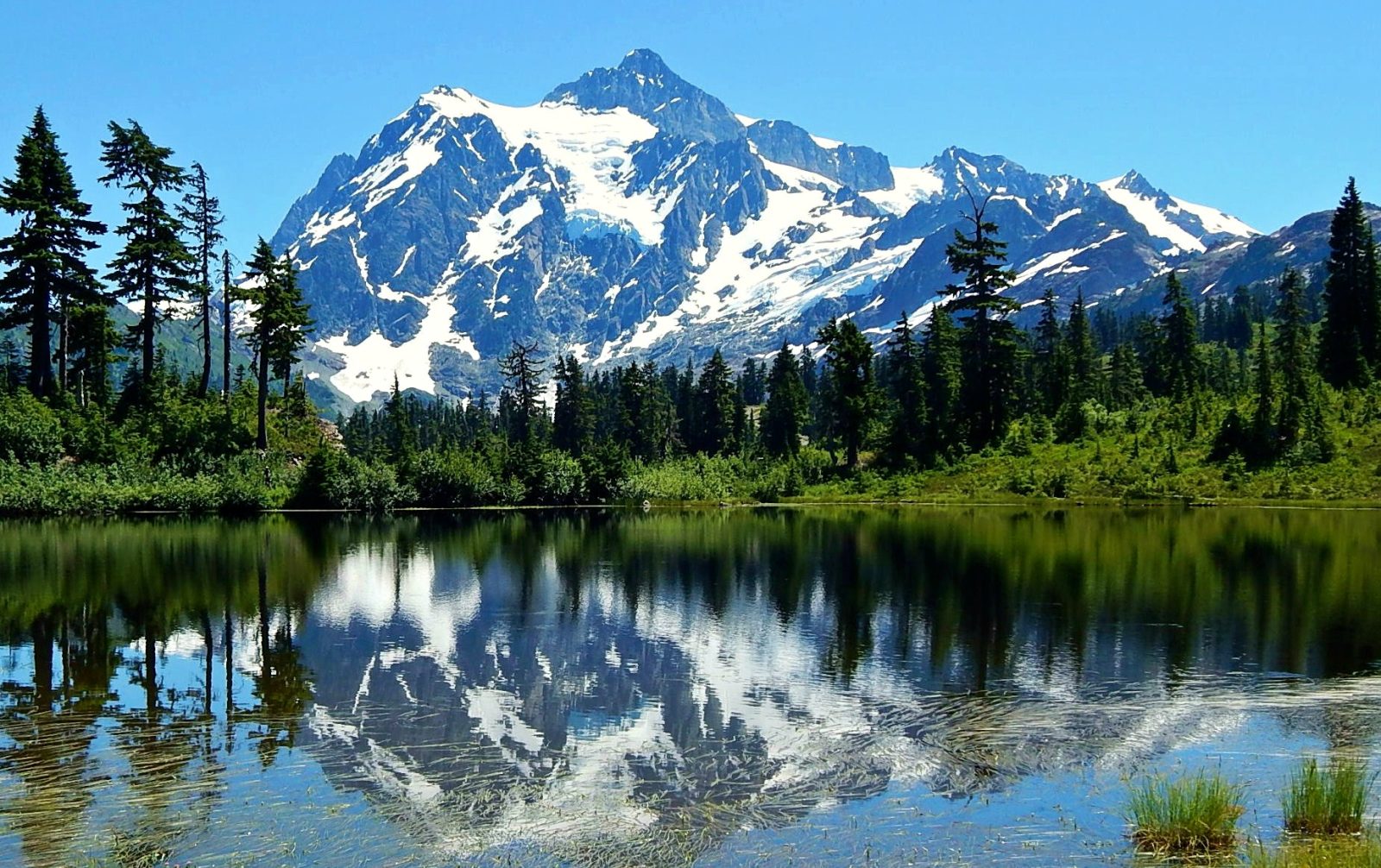
What there is to do here depends heavily on the month. Skiing and snowshoeing run roughly late November through April. Wildflowers peak at 4,000 to 6,500 feet in late July and August, the same window huckleberries ripen. The road to Artist Point exists for only about four months a year. Fall brings chanterelle and matsutake season along with the corridor's actual fall color, which is huckleberry red and vine maple, not larch. Here's what's realistically open and worth doing, organized by when you're going.
Winter (late November–April)
Mt. Baker Ski Area is the anchor of this season, running two base areas — White Salmon (milepost 52) and Heather Meadows (milepost 55) — with eight fixed-grip quads and two handle tows, typically 9:00 a.m. to 3:30 p.m. daily. The complete ski area guide covers lifts and terrain in full, including the logistics of getting there; what to do near Mt. Baker in winter besides skiing covers everyone else in your group.
Skiing isn't the only winter activity, though it's the one most people plan around. Salmon Ridge Sno-Park, about 46 miles up SR 542 from I-5 Exit 255, has 15 miles of groomed non-motorized trails maintained from December 1 through March 31 in partnership with the Nooksack Nordic Ski Club — a Sno-Park permit is required, and the 40-vehicle lot fills on weekends. Snowshoeing and glade skiing happen informally near Bagley Lakes at Heather Meadows, though real avalanche exposure starts once you're off the flats — this is not casual terrain the moment you leave the groomed area.
A few things worth knowing before a winter trip: there's no managed tubing park anywhere on this corridor, and sledding is banned inside the ski area boundary — informal sledding happens roadside near Picture Lake, but check current signage before assuming it's allowed. Overnight parking at the ski area requires an advance reservation. And winter driving above Glacier can require chains regardless of drivetrain; carry them even in a 4WD vehicle. If you're basing near the mountain to ski multiple days, cabins in Glacier cut the daily drive to about 30 minutes each way.
If it's your group's first trip, lock in lift tickets and lessons ahead of time rather than assuming you can sort it out at the base. Rentals are worth reserving too. Lift ticket prices and lessons and rentals cover what to book and, in the case of lift tickets, the corridor's long-standing window-only sales policy that catches first-time visitors expecting to buy online.
Anyone heading into the backcountry — Shuksan Arm, Hemispheres, or the Table Mountain/Herman's Saddle/Swift Creek zone via the Backcountry Lot — should check the Northwest Avalanche Center forecast before leaving the lot, every time, regardless of how the previous trip went. This is an open-boundary area, not a gated one; responsibility for avalanche conditions sits with the skier, not the ski area.
Spring (roughly April–early June)
Spring here is a shoulder season more than a destination in its own right — the ski area is often still running on its typical late-April closing schedule while lower-elevation trails start to open up. Spring at Mt. Baker covers what corn snow and shoulder-season pricing actually look like in more detail. This is also when morel season starts in burn areas, typically April through June, for anyone with a foraging permit.
The Artist Point road itself is still closed at this point in most years. It reopened June 10 in 2026, June 27 in 2025, and June 21 in 2024 — the pattern is "sometime in June," not a fixed date, and it depends entirely on snowpack. Check current status before building a spring trip around it.
Summer (June–early September)
This is when the highest-elevation trails become accessible, and when most of the corridor's marquee hiking happens. Once the Artist Point road clears, high alpine trails like Table Mountain and the Chain Lakes Loop open up — Ptarmigan Ridge too — though early-summer hikers should expect lingering snow on north-facing sections and at higher passes. Trail stats throughout this guide and its linked spokes come from Washington Trails Association, which is worth checking directly for the latest trip reports before you go. Things to do in summer and the best hikes near Mt. Baker go into the trail-by-trail detail.
July brings the worst of the mosquitoes in subalpine meadows, right after snowmelt, along with the start of wildflower season. Late July through August is peak bloom at 4,000 to 6,500 feet — Skyline Divide, Yellow Aster Butte, Chain Lakes and Table Mountain are the standard destinations, covered in full in the wildflower season guide. Huckleberries ripen in roughly the same window and elevation band, from about 4,000 to 6,000 feet; huckleberry picking near Mt. Baker covers permits and spots, plus the household cap.
Water is part of a lot of summer trip plans here, and it deserves a direct warning before anything else: the North Fork Nooksack River is glacially fed, fast, cold and full of logjams. On June 17, 2022, a commercial raft flipped near Glacier and two passengers drowned even though they were wearing wetsuits and PFDs, helmets included. Whatcom County Public Works has formally warned that the river's logjams and debris "can quickly pull and trap water recreationists underneath." There is no verified maintained swimming hole on the North Fork. If swimming is the goal, Silver Lake near Maple Falls and the region's alpine lakes are the places to actually get in the water — not the river itself, no matter how good it looks from a bridge.
Fishing is possible at Silver Lake (stocked rainbow trout, season late April to late October) and Baker Lake (kokanee, bull trout, rainbow and sockeye, in a different corridor off SR 20, about two hours from Glacier). The Nooksack forks themselves are managed by WDFW under frequent emergency rule changes, including repeated closures tied to hatchery spring Chinook — there is no fixed season to quote, and the only reliable approach is checking wdfw.wa.gov the week of your trip. Fishing near Mt. Baker covers all three fisheries in detail.
Anyone hiking or camping here before the current bear food-storage order expires in April 2027 should know its terms: food, refuse and any other attractant must be stored bear-resistant, day and night, forest-wide. Penalties run up to $5,000 for an individual and $10,000 for an organization. Black bears, black-tailed deer and mountain goats are all present; elk are mostly found south of the wilderness boundary.
Fall (September–mid-October)
Fall color here starts at elevation in September and peaks mid-September into October, right around when the Artist Point road closes for the season. It's worth saying plainly: this corridor does not have golden larch. The larch destinations people are often picturing — Cathedral Provincial Park, the Pasayten, Glacier Peak, Cascade Pass — are all in other parts of the Cascades. What you'll actually see here is huckleberry foliage turning red at elevation and vine maple color lower down. Meadows shift color too, and the combination is worth the trip on its own terms without pretending it's something it isn't. Fall at Mt. Baker covers timing and where to see it.
Fall is also mushroom season: chanterelles run roughly October through November, matsutake September through October. A free personal-use foraging permit is required in person at a ranger district office — not by phone or online — with a combined household cap of five gallons per year across mushrooms and berries, plus any other forest plants, forest-wide. The US Forest Service is the authority to check for the current permit process, since it's updated more often than a static article can track. All designated Wilderness, including much of the Mount Baker Wilderness that these trails run through, is closed to foraging even with a permit. Mushroom foraging near Mt. Baker covers the permit process and where the Wilderness boundary actually falls.
Year-round: photography and stargazing
Mt. Baker and Mt. Shuksan get photographed constantly, and one confusion comes up more than any other: the famous Picture Lake reflection shot most people associate with "Mt. Baker" is actually Mt. Shuksan, the jagged peak next to it. Photographing Mt. Baker and Mt. Shuksan sorts out which viewpoint shows which mountain.
For stargazing, be precise about what's actually true: there is no official Dark Sky designation anywhere on this corridor. Artist Point and Heather Meadows are informally good for stargazing simply because of their elevation and distance from city light domes, which is a real and useful fact — it's just not a certification. Stargazing near Mt. Baker covers what conditions actually look like without overstating them.
Doing all this with kids
Several of the activities above scale down well for families — the Picture Lake loop is short and paved (ADA-accessible, too), and Horseshoe Bend is a low-elevation, year-round trail near Glacier that doesn't demand much from small legs. Mt. Baker with kids pulls together the trails and seasons that work for a family trip, along with the logistics, rather than a solo hiking trip.
Passes and permits, by activity
Almost everything on this page needs a piece of paper or a permit, and they're not interchangeable:
| Pass | Cost | Covers |
|---|---|---|
| Northwest Forest Pass | $5/day, $30/year | USFS trailheads with facilities — nearly all the hikes above |
| America the Beautiful | $80/year | Accepted in place of the NW Forest Pass, plus National Parks |
| Discover Pass | $10/day, $45/year | WA State Parks / DNR / WDFW land, including Silver Lake's boat launch |
| Sno-Park permit | $25/day, $50/season | Designated winter parking lots, November 1–April 30 |
The Discover Pass and Northwest Forest Pass are not interchangeable, even though both are common on this corridor — check which land manager owns the trailhead you're headed to. Trailhead passes explained breaks this down further if you're stacking multiple activities into one trip.
If you're planning anything overnight, the Mount Baker Wilderness — 117,900 acres, designated in 1984, covering much of the higher terrain these trails climb into — caps group size at 12 and prohibits leaving gear unattended for more than 48 hours. Camping is also banned within two miles of several trailheads from May 15 through mid-November, so a "just camp near the car" backup plan doesn't work everywhere.
When roads and lodging change what's possible
A fair amount of what's "open" here depends on infrastructure as much as season. The Mt. Baker Highway itself has had real closures — a December 2025 atmospheric river damaged embankments near Wells Creek and O'Keefe Creek and shut the highway for days before permanent repairs finished in February 2026. Road conditions covers how to check current status before you drive up, and forest road closures covers the trailhead access roads specifically, several of which have had multi-year washouts.
None of this is a reason to skip a trip. It's a reason to check current status the week you're going rather than trusting a date on a page like this one, however recently it was written.
A season-at-a-glance summary
| Season | Access status | Best for | Watch out for |
|---|---|---|---|
| Winter | Ski area open ~late Nov–April | Skiing, Sno-Park nordic trails | Chains, no online lift ticket sales, backcountry avalanche risk |
| Spring | Artist Point road typically still closed | Shoulder-season value, morels | Snowpack-dependent access, variable weather |
| Summer | Artist Point road open (varies, usually by mid-to-late June) | Alpine hiking, wildflowers, huckleberries | Mosquitoes in July, no swimming in the Nooksack |
| Fall | Artist Point road open into mid-October | Fall color, mushroom foraging | No larch here; foraging permit required in person |
FAQ
Is there a best time of year to visit Mt. Baker?
It depends entirely on what you want to do. The ski area only runs in winter, the high alpine trails only open once the Artist Point road clears for summer, and fall color and mushroom season have their own separate window again after that — there isn't a single answer that fits every kind of trip.
Can I forage for mushrooms or berries here?
Yes, with a free personal-use permit obtained in person at a ranger district office, subject to a combined five-gallon annual household cap and a hard closure on all designated Wilderness even with a permit.
Is there a Dark Sky designation at Mt. Baker?
No. Artist Point and Heather Meadows are informally good for stargazing due to elevation and distance from cities, but there is no official Dark Sky certification here.
Can I swim in the Nooksack River?
No — not safely. It's glacially fed and fast-moving, choked with logjams, and it was the site of two drowning deaths in June 2022 despite full safety gear. Silver Lake and the region's alpine lakes are the places to swim instead.
Is the road to Artist Point open year-round?
No. It closes with the first significant snowfall each year and reopens sometime in June once crews clear it — the reopening date varies by several weeks year to year depending on snowpack.
What to do next
Pick the season you're actually traveling in first, then use the linked season guide above for trail-by-trail and date-specific detail — conditions here change enough year to year that a general overview like this one is a starting point, not the last word.
Written by the team at Stay at Mt Baker, who manage cabins in Glacier, Maple Falls, Mt. Baker Rim, Glacier Springs, Snowline, Snowater and Silver Lake. Last checked: August 2026.